Privacy Blurring, Saved Views, PDF Deviation Reports and More
This release brings a range of new features and enhancements across SkyGIS.
Simplified POI Creation
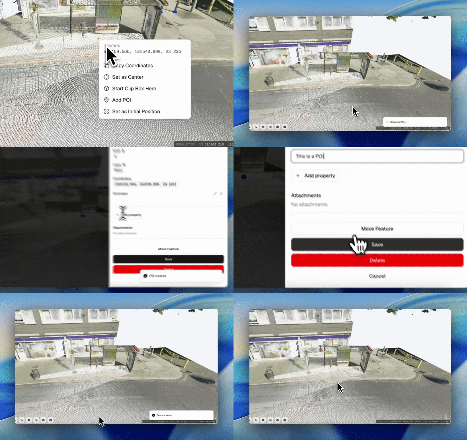
Adding Points of Interest is now effortless. Just right-click anywhere in the point cloud, select Add POI, and enter your comment - the POI appears instantly, with no need to create a separate vector layer first.
Saved Views
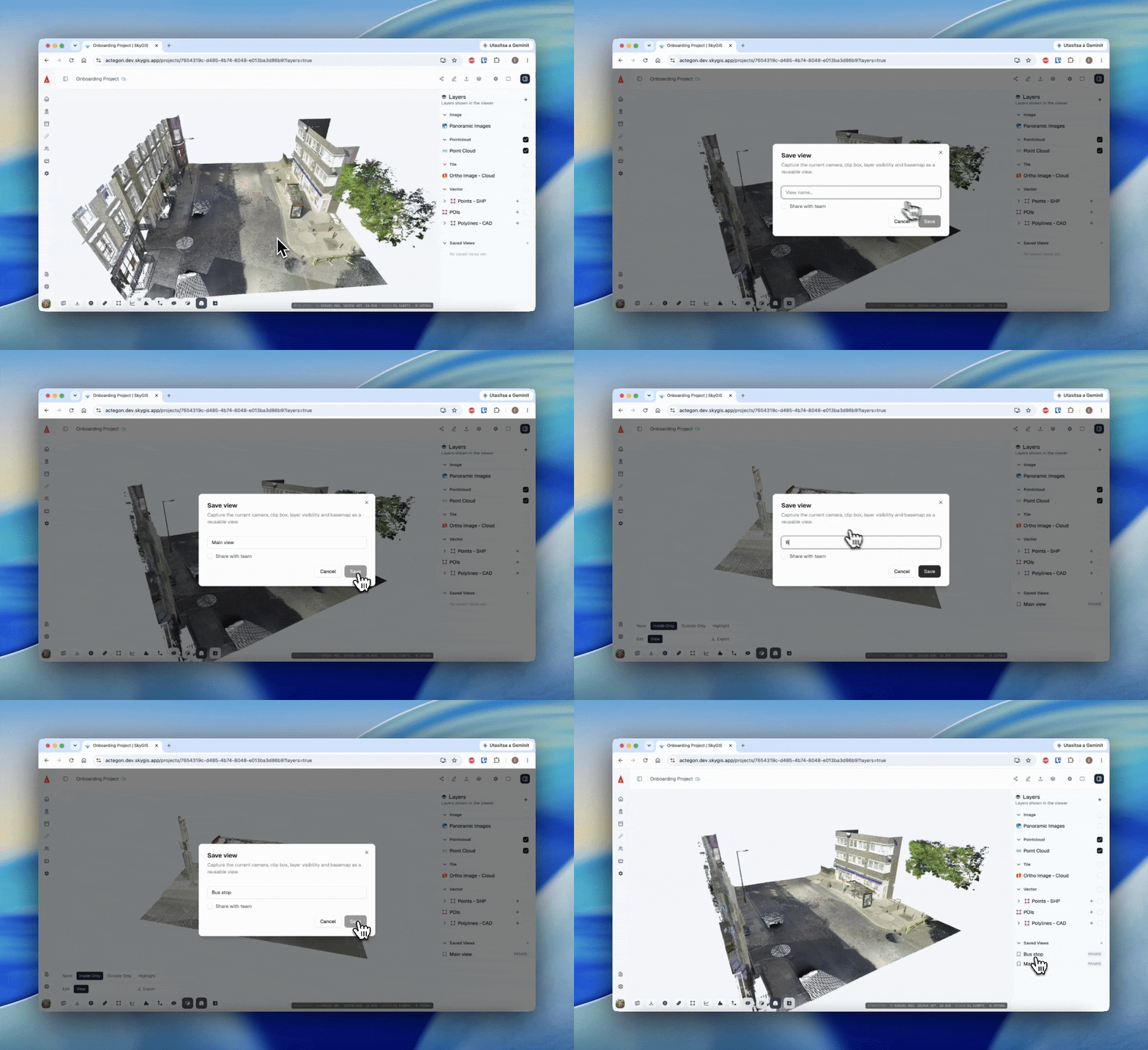
You asked, we listened. You can now save your current view directly from the Saved Views option in the Layer Panel, with support for both private and shared views. Each saved view retains camera settings, layer states, and clipping box parameters, so you can jump back to any important perspective in a single click.
Deviation Analysis Report
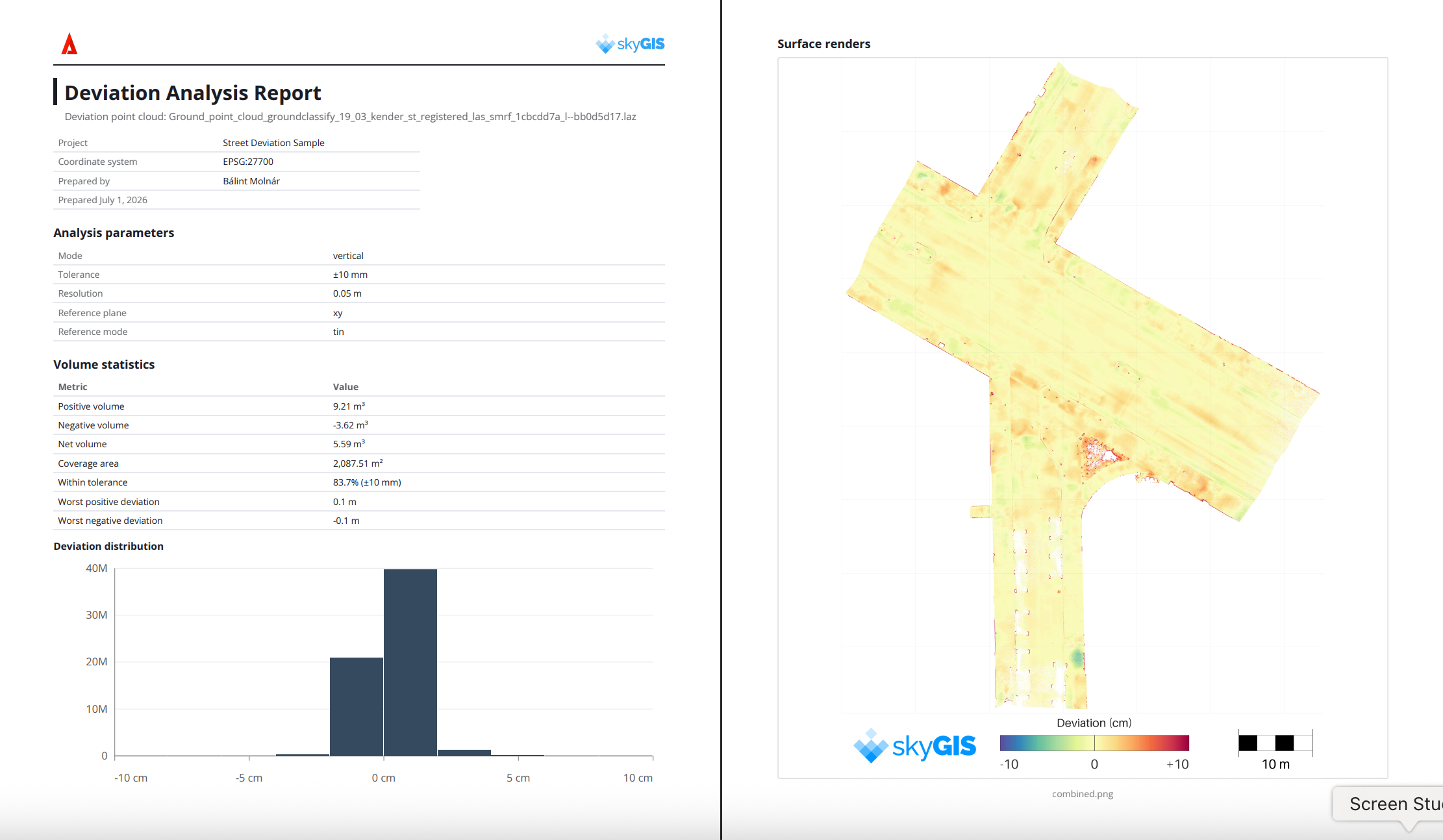
Deviation rasters and point clouds are now accompanied by a comprehensive PDF report. It captures key deviation metrics, calculated volumes, cut/fill values, and a visual rendering to help you orient yourself within the project area. The result is detailed, professional surface-to-cloud deviation documentation - clear records of your results and dependable volume calculations to support planning, validation, and decision-making on future construction and earthworks projects.
Enhanced Orthographic Camera
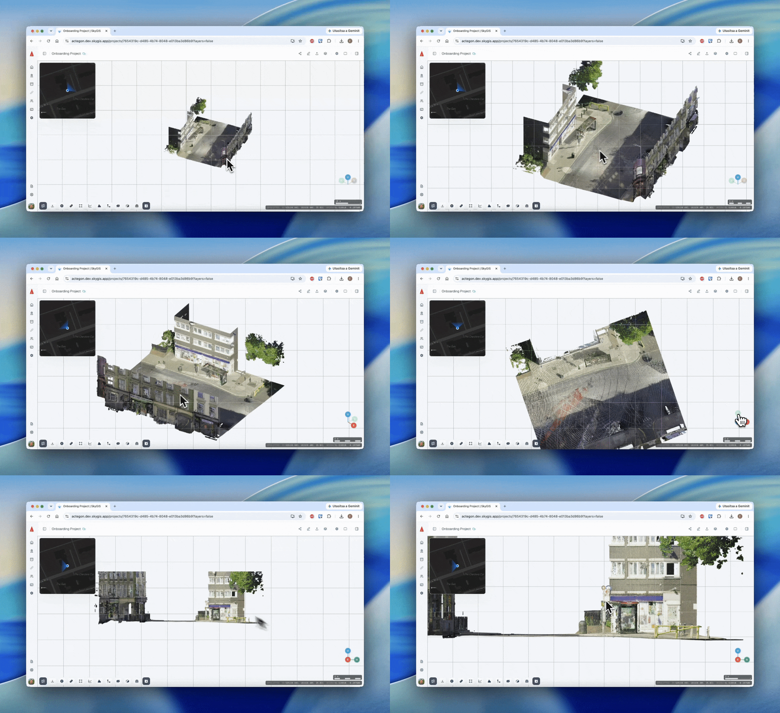
The Orthographic Camera now offers an optional grid overlay, toggled on in the settings. The grid adapts dynamically to your current view and scale, letting you quickly gauge distances and spatial relationships directly within the data. By providing a consistent visual reference across perspectives, it streamlines navigation, interpretation, and measurement.
License Plate and Face Blurring
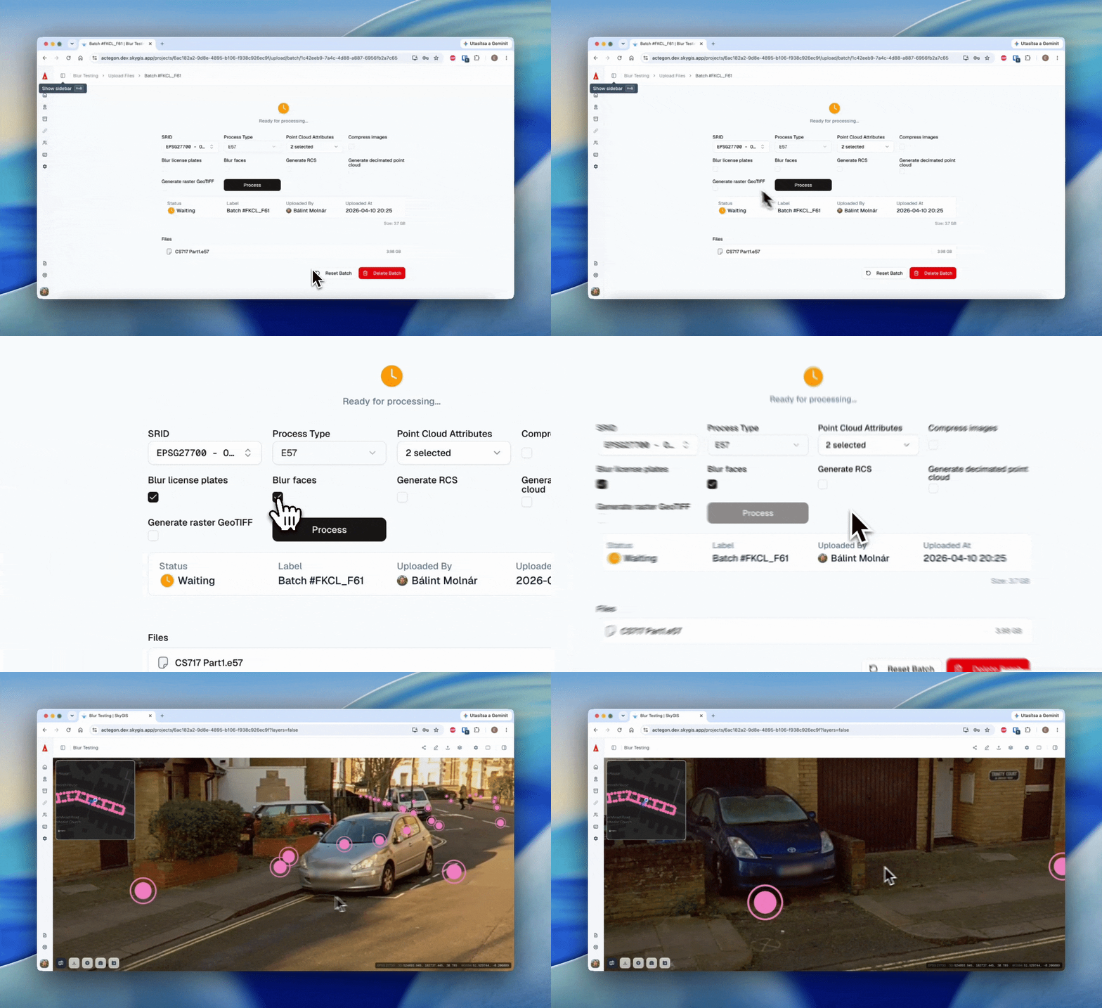
The first release of our automatic license plate and face blurring tools is here, supporting privacy-protection workflows.
Measurement Snapping
Snapping can now be enabled from the settings menu. It supports endpoints, center points, and edges for more precise measurements.
LandXML Deviation Analysis
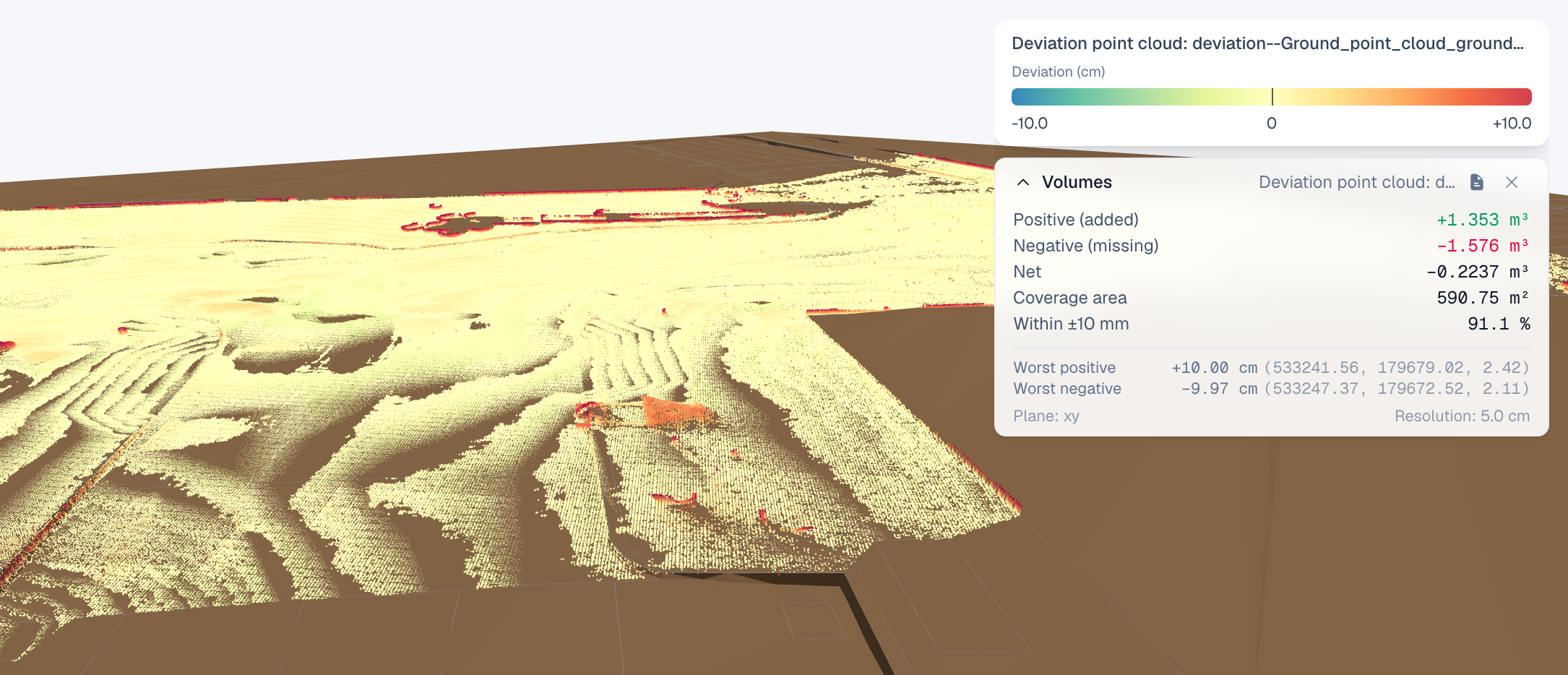
Deviation Analysis now works with LandXML surfaces, so you can run deviation analysis directly against LandXML-based terrain and design surfaces — giving you more flexibility when comparing surveyed data against project specifications.
Other Features and Improvements
Measurement Improvements — Delete all measurements at once, instead of removing them one by one.
Billing Manager Role — A new dedicated role for managing your organization's billing.
GeoPackage Support — Upload vector data in the GeoPackage (GPKG) format.
Google KML/KMZ Support — Import Google KML and KMZ files for use as vector layers in SkyGIS.
GeoTIFF Enhancements — Orthophoto generation from point clouds is now even smoother: an orthophoto can be created right after upload, removing extra processing steps and speeding up data preparation.
Batch Naming — Your company logo now appears in shared links, helping partners and clients connect your brand to the products and deliverables you share.
As always, if you have an idea for a new feature or run into a bug, we'd love to hear from you. Your feedback helps us keep improving SkyGIS.